Thursday, July 31, 2025

Counts of occurrence per depth in 秋田県北部

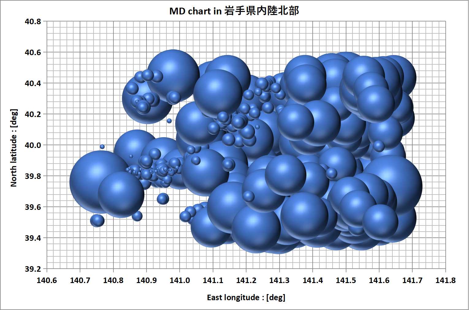
Counts of occurrence per depth  in 秋田県北部(Northern Akita Pref.)is shown as below graph, 

The greatest magnitude is M6.8 of 1km in 1938. It was occurred on the quartet junction among 1km-30km. By the M6.8, their counts increase rapidly. 1km curve stood out as the fastest, and kept the 1st count until be overtaken by 10km curve. Only 10km curve was affected remarkably by M9.0 of Great East Japan Earthquake. The total counts of 1km-20km account for about 94% of all occurrences in this area.    


  • 1km (red)…The count is the 2nd. There is the rapid increase after M6.8 of 1km in 1939 after the 2nd longest silent term between 1919-1933. The next remarkable rapid increase started since 1969 until 1979. It may be due to the influence of M7.9 of 1km in Off the East Coast of Aomori Pref in 1968. The 1st longest silent term is between 1982-1997. After it, the silent terms became shorter. But, 1km curve was overtaken by 10km curve in 2012. The M6.8 in 1939 is the greatest one of all depths. The M6.8 was occurred on the quartet junction among 1km/10km/20km/30km.
  • 10km (yellow)…The count is the 1st. As same as 1km, there is the rapid increase after M6.8 of 1km in 1939. Then, the silent terms became longer suddenly. The longest silent term is between 1939-1955. After it, the count increased with steep sloop. After M9.0 of Great East Japan Earthquake, the rapid increase was occurred. In result, 10km curve overtook 1km curve. The largest of 10km is M6.2 in 1998.
  • 20km(orange)… The count is the 3rd.  As same as 1km/10km, there is the rapid increase after M6.8 of 1km in 1939. Then, the silent terms became longer suddenly. The 2nd longest silent term is between 1939-1959. After it, 20km curve went back-and-forth of 10km until 1983. As 10km curve had the 2nd longest silent term between 1982-1993, 20km curve overtook 10km curve. But, as 10km curve became increase rapidly since 1993, 20km's count rank became down to the 3rd. The largest of 20km is M6.5 in 1939. 
  • others… Remaining counts except 1km-20km are only 6%.    


M8.8 in Kamchatka Peninsula

As you know, M8.8 was occurred in felt Kamchatka Peninsula. Japan Meteorological Agency's database of felt earthquakes doesn't include so many data of earthquakes around Kamchatka Peninsula because of too far from Japan.

Therefore, there are only 7 earthquake data set including M8.8. In addition to it, these epicenter's depths are different from each other.  It makes the data analysis very difficult to use the methods shown in Data Catalogs (ex. Data Catalog of Earthquakes around Hokkaido of Japan Area).

As far as I can, I will show the data analysis to be worthy of special mention as below,

  1. Analysis for the line chart of epicenter(Lat/Lng)
    The 1st graph is the trend graph of East longitude of epicenters (called as E-T chart). Since 2nd earthquake in 1923, the epicenter locations had the tendency of the movement to west direction until 6th earthquake in 2020. Then, in 2025, M8.8 is occurred in East end of the range of 7 epicenters. As same as, 2nd graph is called as N-T chart. In N-T chart, no tendency of the trend may be not found. But, M8.8's epicenter is located on the South end of f the range of 7 epicenters. In the case of M9.0 of Great East Japan Earthquake in 2011, the epicenter was located near the edge.   
  2. Analysis for the Magnitude-epicenter(Lat/Lng) 
    There are 7 earthquakes data. But, 2 earthquakes are unknown of their magnitudes. In the graphs above, black lines are topside envelope. The extended black lines go through nearby M8.8. Red lines are the approximate straight lines of selected epicenters(red labels). To be noticed, the selected epicenters are different from each other in Longitude graph/in Latitude graph. Unfortunately, no information may be found when M8.8 would have gotten from these graphs.

    The below graphs are same in 三陸沖 (Sanriku-oki) including M9.0 between 1919-2011/3/11 (just until M9.0 occurrence). Similar with in  Kamchatka Peninsula, there are black topside envelop lines near M9.0 in 2011. Red lines are the approximate straight lines of selected epicenters. The correlation coefficients show the high value as almost 1.0000. 
As showed above, the max magnitudes may be guessed to some extent in the specific area. But, there is no way when they will be occurred by this chart.   

Wednesday, July 30, 2025

MD-T chart in 秋田県北部

MD-T chart in 秋田県北部(Northern Akita Pref.)


MD chart in 秋田県北部

MD chart in 秋田県北部(Northern Akita Pref.)


Dragon chart in 秋田県北部

 Dragon chart in 秋田県北部(Northern Akita Pref.)


Sum of Magnitude per 1day in 秋田県北部

Sum of Magnitude per 1day in 秋田県北部(NorthernAkita Pref.) 

note : Horizontal axis isn't linear.

Distribution of Magnitude in 秋田県北部

Distribution of Magnitude  in 秋田県北部(Northern Akita Pref.)


Distribution of Depth in 秋田県北部

Distribution of Depth in 秋田県北部(Northern Akita Pref.)


Area map of 秋田県北部

Area map of 秋田県北部(Northern Akita Pref.)is defined for epicenter's analysis as below,  


Saturday, July 26, 2025

Counts of occurrence per depth in 宮城県中部

Counts of occurrence per depth in 宮城県中部(Central Miyagi Pref.) is shown as below graph, 

10km count occupies about 80% of all occurrences. 1km/10km counts continue as the 2nd/3rd. On the other hand, 50km/40km/30km's ranks are below 10th. Even though outside of this area, M7.2 in 三陸沖 (Sanriku offshore) in 1989 seems to make the deep relationship with 1km/10km's behavior as below, 

  • 1km (red)…The count is the 2nd. Most of them (53/67=79%) were unknown details (with no magnitude data). There was the steep slope between 1919 - 1926. Then, there were several long silent terms and low steps including the longest silent term between 1978-2003. This longest silent term end was only about 2 months before M5.6 of 10km in 2003, and no more 1km occurrence in this area at this moment. During this term, 10km curve overtook 1km's one.  The largest earthquake of 1km is M4.4 in 1962.       
  • 10km (yellow)…The count is the 1st. After the longest silent term between 1919 - 1930, 10km curve increased steadily and became the 2nd in 1970 by overtaking 70 km curve. As the other curves increased lower, 10km curve could keep the rank as the 2nd. Between 1970-1989, there were 4 times of the periodic long silent terms with 5 years of long silent term (Only the last one was about 4 years). 6 months later, M6.2/M6.5/M7.2 was occurred in 三陸沖 (Sanriku offshore) outside of this area in 1989. They may have any relationships each other. Anyway, after 4 periodic long terms, the silent terms became shorter rapidly before M5.6 of 120km in 1992/M5.8 of 110km in 1993. After further 4 years with the long silent term, the terms became shorter suddenly. Especially, there were 2 major rapid increases of in 1998/2003. The 1st increase might have the relationship with M6.1 of 10km in 岩手県内陸北部(outside of this area). But, the distance seems to be too far. The 2nd one was caused by M7.1 of 70km in the border between prefectures between Miyagi and Iwate near their coastlines(outside of this area, too). Further 3 weeks later, the longest silent term (for 25years) of 1km was broken and then 10km curve was accelerated. In result, M5.6/M6.4 of 10km were occurred in the continuing earthquakes since 1997. The M6.4 is the greatest one of all depths in this area. 
  • 20km (orange)…The count is the 3rd. The longest silent term is between 1919 - 1958. There was the main rapid increase by M6.3 of 10km in 2003. The largest earthquake of 20km is M5.2 in 2016.    
  • 70km (purple)…The count is the 4th. The largest earthquake of 70km is M6.0 in 1945. After the M6.0, the silent terms became longer. The longest silent term is between 1986-2007. The silent terms became shorter suddenly after the longest. The 70km curve rose up following 20km curve behind just before 80km curve catching up with.
  • 80km (navy)…The count is the 5th. The largest earthquake of 80km is M5.6 in 1931. After the M5.6, the 80km curve was following behind 70km curve. But, no catching up with 70km curve after all.
  • 60km (blue)…The count is the 6th. There were 2 major increases. One was between 1967-1970. The other was the rapid one in 1978. After them, there was the longest silent term between 1978-2012. Only 2 earthquakes after it, there was. The largest earthquake of 60km is M4.6 in 1941.
  • others…90km/100km/110km' s ranks continue as 7th/8th/9th. 50km/40km/30km's ranks are below 10th.

Friday, July 25, 2025

MD-T chart in 宮城県中部

MD-T chart in 宮城県中部(Central Miyagi Pref.) 


MD chart in 宮城県中部

MD chart in 宮城県中部(Central Miyagi Pref.) 


Dragon chart in 宮城県中部

Dragon chart in 宮城県中部(Central Miyagi Pref.) 


Sum of Magnitude per 1day in 宮城県中部

Sum of Magnitude per 1day in 宮城県中部(Central Miyagi Pref.) 

note : Horizontal axis isn't linear.
 

Distribution of Magnitude in 宮城県中部

Distribution of Magnitude in 宮城県中部(Central Miyagi Pref.) 


Distribution of Depth in 宮城県中部

Distribution of Depth in 宮城県中部(Central Miyagi Pref.) 


Area map of 宮城県中部

Area map of 宮城県中部(Central Miyagi Pref.)is defined for epicenter's analysis as below,  


Wednesday, July 23, 2025

Counts of occurrence per depth in 宮城県南部

Counts of occurrence per depth in 宮城県南部(Southern Miyagi Pref.) is shown as below graph, 

1km/10km are 2 tops of count ranking. Next is 90km. 20km-80km are low ranks under 6th including no occurrences. Most of 1km were unknown details (with no magnitude data). 

  • 1km (red)…The count is the 1st. Most of them (152/159=96%) were unknown details (with no magnitude data) except only 5 times. The rapid increase was occurred in 1938. They may be caused by aftershocks of M7.1 of 60km in 1937 (The epicenter was off the coast of Miyagi Prefecture outside of this area). After the rapid increase, the silent terms became longer and longer. The longest silent term is between 1975-2005. The next longest silent term is continuing still now (for 20 years).  The largest earthquake of 1km is M4.4 in 1962.   
  • 10km(yellow)…The count is the 2nd.  After the long silent terms including 2nd / 3rd, M6.0 of 10km was occurred in 1956. The M6.0 is the greatest one of all depths. There were 2 major rapid increases both in 1998/2011. Both of then were caused by M5.2s of 10km. In result, the count has approached very nearby 1km's one.
  • 90km(brown)…The count is the 3rd. During 1950-1990, 90km curve were back and forth of 10km curve. But, during the longest silent term of 90km between 1986-1999, the curve became far from 10km curve. The largest earthquake of 90km is M5.9 in 1960. The M5.9 was occurred at the timing of overtaking 100km curve.
  • 100km(gray)…The count is the 4th. After being overtaken by 90km in 1960, the silent terms became longer. The largest earthquake of 100km is M5.0 in 1947. 
  • 110km(gray)…The count is the 5th. The largest earthquake of 110km is M5.0 in 1951.  
  • 20km(orange)…The count is the 6th as same as 120km. There was the longest silent term between 1936-1999 for 63 years. The largest earthquake of 20km is M4.0 in 2011. 
  • others…omitted.

Monday, July 21, 2025

MD-T chart in 宮城県南部

 MD-T chart in 宮城県南部(Southern Miyagi Pref.)


MD chart in 宮城県南部

MD chart in 宮城県南部(Southern Miyagi Pref.)


Dragon chart in 宮城県南部

Dragon chart in 宮城県南部(Southern Miyagi Pref.)


Sum of Magnitude per 1day in 宮城県南部

Sum of Magnitude per 1day in 宮城県南部(Southern Miyagi Pref.)

note : Horizontal axis isn't linear.

Distribution of Magnitude in 宮城県南部

Distribution of Magnitude in 宮城県南部(Southern Miyagi Pref.)


Distribution of Depth in 宮城県南部

Distribution of Depth in 宮城県南部(Southern Miyagi Pref.)


Area map of 宮城県南部

Area map of 宮城県南部(Southern Miyagi Pref.)is defined for epicenter's analysis as below,  


Counts of occurrence per depth in 宮城県北部

Counts of occurrence per depth in 宮城県北部(Northern Miyagi Pref. )is shown as below graph,  

1km/10km/20km was keeping their ranks as the 1st-3rd between 1965 - 1980. But, 20km increase became slow and M7.1 of 70km in 2008 made jump up 70km / 60km / 50km curves. The M7.1 was occurred on the triple junction among 70km / 60km /80km curves.   


  • 1km (red)…The count is the 3rd. There are 3 major rapid increases. The 1st one was occurred between 1940-1942. 22 earthquakes were occurred, and all of them were unknown of the magnitudes. They seem to be the foreshocks of M6.0 of 70km in 1945. The 2nd one was occurred by M6.5 of 20km in 1962. By the M6.4, both of 1km/10km had the rapid increases. But, 1km increase was far more.  After the rapid increase of 1km, there was the longest silent term between 1980-1996. The silent term was broken by M6.1 of 10km in 1996. Furthermore, there was also the 6th longest silent term between 1996-2002. After these 2 long silent terms, the silent terms became shorter since M7.1 of 70km in 2003. By the M7.1, 10km curve increased rapidly and overtook 1km. The 3rd rapid increase was occurred by the M7.2 of 10km in 2008. After the 3rd, there was the 5th longest silent term between 2012-2019. During the long silent term, 70km curve caught up with and overtook 1km curve. The largest earthquake of 1km is M5.1 in 1996.
  • 10km(yellow)…The count is the 1st. After M6.5 of 20km in 1962, the count rank became the 2nd. The count also stepped up by M6.1 of 10km in 1996, M6. 1 of 10km in 1996, M7.1 of 70km in 2003, and M7.2 of 10km in 2008. Before and after the M7.1 of 70km in 2003, 1km curve crossed with 10km and 70km curves. But, 10km and 70km didn't cross around 2003. Before the M7.2 of 10km in 2008, there were 2 long silent terms of 20km between 1986-1999 (the 2nd length) / between 2004-2007 (the 9th length).  The largest earthquake of 10km is M7.2 in 2008, and the greatest one of all depths.
  • 70km(purple)…The count is the 3rd. 70km curve has been kept 4th or more in the whole period. Especially, M7.1 of 70km in 2003 made the count jump up rapidly and rank up. The M7.1 was occurred on the triple junction among 70km / 60km /80km curves. Before it, there was another triple junction among 60km / 80km / 20km. But, as there was no increase of 20km just after the M7.1, it may be twin junction between 60km/80km. One more reason of the twin junction, 20km may be too far from 60km/80km to interact with.  The largest earthquake of 70km is M7.1 in 2003.  
  • 60km(blue)…The count is the 4th. The 60km curve was following 70km behind. But, almost all time, 60km count was less than 70km. Especially during the 2nd longest silent term between 1991-2003, the difference of counts became more. The 2nd silent term was broken by the aftershock just after M7.1 of 70km in 2003. 60km curve also jumped up by the M7.1. The increase was far less than 70km by the M7.1 even though Great East Japan Earthquake (M9.0) also made 60km jump up in 2011. (The epicenter of M9.0 is outside of this area). The largest earthquake of 60km is M6.9 in 2021.  
  • 50km(light blue) …The count is the 5th. There were 4 long silent terms between 1919-1929(5th)/1932-1947(2nd)/1950-1961(4th)/1965-1976(3rd). After them, 50km curve's slope became steeper. The only rapid increase was caused by Great East Japan Earthquake (M9.0) . In result, 50km overtook 80km curve. The largest earthquake of 50km is M4.9 in 1947.  
  • 80km(navy)…The count is the 6th. There was the rapid increase by M7.1 of 70km in 2003 after 110km curve catching up with. But, 80km curve almost couldn't catch up with 60km curve and was overtaken by 50km curve. The largest earthquake of 80km is M4.9 in 2021.    
  • 20km(orange) …The count is the 7th. The rank was the 3rd between 1965 - 1980. But, because of both the 2nd longest silent term between 1986-1999 and the slow increase after it, the rank went down.  The largest earthquake of 20km is M6.5 in 1962. 
  • others… omitted. 

Saturday, July 19, 2025

MD-T chart in 宮城県北部

MD-T chart  in 宮城県北部(Northern Miyagi Pref. )


MD chart in 宮城県北部

MD chart in 宮城県北部(Northern Miyagi Pref. ) 

note : M't Kurikoma is a volcano.
 

Dragon chart in 宮城県北部

 Dragon chart in 宮城県北部(Northern Miyagi Pref. )


Sum of Magnitude per 1day in 宮城県北部

 Sum of Magnitude per 1day in 宮城県北部(Northern Miyagi Pref. )

note : Horizontal axis isn't linear.
  

Distribution of Magnitude in 宮城県北部

Distribution of Magnitude in 宮城県北部(Northern Miyagi Pref. )


Distribution of Depth in 宮城県北部

 Distribution of Depth in 宮城県北部(Northern Miyagi Pref. ) 


Area map of 宮城県北部 

Area map of 宮城県北部(Northern Miyagi Pref.)is defined for epicenter's analysis as below,  


Counts of occurrence per depth in 岩手県内陸南部

Counts of occurrence per depth in 岩手県内陸南部(Southern inland of Iwate Pref. )  is shown as below graph,  

Just after M6.2 of 20km in 1970, 1km/10km/20km were occupied the top ranks of the 1st-3rd. But, after M7.1 of 70km on the triple junction among 70km / 80km / 60km in 2003, these rapid increases made the ranks jump up. As M7.2 of 10km in 2008 brought out the rapid increases of 10km/1km, they can keep the high ranks as the 1st/3rd. On the other hand, 20km ranked down from the 3rd to 6th.


  • 1km (red)…The count is the 3rd. Long silent terms seem to make rapid increase be occurred, and they make the curve form as steps. The longest silent term was between 1996-2004, and M7.2 of 10km was occurred 4 years later as the greatest one of all depths. The largest earthquake of 1km is M5.1 in 1996. Before the M5.1, there were also 2 long silent terms of 3rd (2nd) / 6th (4th). (() was the rank at that time) .
  • 10km(yellow)…The count is the 1st. There were 2 major rapid increases. One was the rapid increase by both foreshocks and aftershocks of M5.8 of 10km in 1996. The another was the one by M7.2 of 10km on triple junction among 60km-80km in 2008. The M7.2 is the greatest one of all depths, and the aftershocks made the counts rank up to the 1st by the aftershocks. 
  • 70km (purple)…The count is the 2nd. Before M7.1 of 70km in 2003, the rank was the 3rd. But, the M7.1 made the rank jump overtaking 1km finally. The M7.1 was occurred on the triple junction among 60km/70km/80km (20km was also nearby). The largest earthquake of 70km is the M7.1 in 2003. 
  • 80km (navy)…The count is the 4th. 80km curve was following 70km curve, and the rapid increase was occurred by M7.2 of 70km as same as 70km. But, almost always, 80km curve was located below 70km curve. The largest earthquake of 80km is the M5.3 in 1996.
  • 60km (blue)…The count is the 5th. 60km curve was following 80km curve, and the rapid increase was occurred by M7.2 of 70km as same as 70km/80km. But, almost always, 60km curve was located below 80km curve. The largest earthquake of 60km is the M4.6 in 2018.
  • 20km(orange)…The count is the 6th. But, the rank was the 3rd when there was the rapid increase by M6.2 of 20km in 1970. After the rapid increase, there was the 2nd longest silent term between 1973-1983. On addition to it,the 1st longest silent term was also occurred between 1994-2007. In result, 70km/80km/60km curves overtook 20km curve, and 90km is approaching within reach. The largest earthquake of 20km is the M6.2 in 1970.
  • others…omitted. 

Thursday, July 17, 2025

MD-T chart in 岩手県内陸南部

 MD-T chart in 岩手県内陸南部(Southern inland of Iwate Pref. )


MD chart in 岩手県内陸南部

  MD chart in 岩手県内陸南部(Southern inland of Iwate Pref. )


Dragon chart in 岩手県内陸南部

 Dragon chart in 岩手県内陸南部(Southern inland of Iwate Pref. )


Sum of Magnitude per 1day in 岩手県内陸南部

 Sum of Magnitude per 1day in 岩手県内陸南部(Southern inland of Iwate Pref. )

note : Horizontal axis isn't linear.
 

Distribution of Magnitude in 岩手県内陸南部

Distribution of Magnitude in 岩手県内陸南部(Southern inland of Iwate Pref. )


Distribution of Depth in 岩手県内陸南部

 Distribution of Depth in 岩手県内陸南部(Southern inland of Iwate Pref. ) 


Area map of 岩手県内陸南部

Area map of  岩手県内陸南部(Southern inland of Iwate Pref. )is defined for epicenter's analysis as below, 


Tuesday, July 15, 2025

Counts of occurrence per depth in 岩手県沿岸北部

 Counts of occurrence per depth in 岩手県内陸北部(Northern inland of Iwate Pref. )  is shown as below graph, 

As 20km curve has overtook 1km curve, shallow depths are top group of the counts. On the other hand, 20km curve is under 70km-100km curves. About magnitudes, M6.8 of 110km in 2008 is the greatest one of all depths. Such reversal status seems to be the energy charging mode. The stocked energy may be released huge earthquakes of shallow area as the open end with lots of aftershocks like as domino toppling.


  • 1km (red)…The count is the 2nd. There was the longest silent term between 1988 - 1998. About 2 months later, M6.2 of 10km was occurred and brought out the rapid increase of 1km as the aftershocks. But, the increase of 10km had more aftershocks. The largest earthquake of 1km is M5.4 in 1927.
  • 10km(yellow)…The count is the 1st. After becoming the 2nd by overtaking 80km, there was the rapid increase until 1963. Then, the silent terms became longer suddenly. During it, 80km curve caught up with 10km curve. But, back to back, the 80km curve had the longer silent terms. So, 10km curve became the 2nd again and the silent terms became shorter and shorter. Since May / 1998, the rapid increase began. They led to M6.2 of 10km in Sep/1998, and many aftershocks. On the way overtaking the 1km curve, the rapid increase is continuing still now. The longest silent term is between 1968 - 1982. The largest earthquake of 10km is M6.2 in 1998 (It was M5.0 in 1986 before M6.2).
  • 80km(navy) …The count is the 3rd. Except the terms overtaken by 10km curve, 80km kept the 2nd. The largest earthquake of 80km is M4.9 in 2013.
  • 90km(brown) …The count is the 4th. 90km is following behind 80km curve. But, it couldn't have caught up with 80km curve still. The largest earthquake of 90km is M5.9 in 1955.
  • 70km(purple)…The count is the 5th. 70km is following behind 90km curve. But, it couldn't have caught up with 90km curve still. (It means 80km > 90km> 70km anytime.) The largest earthquake of 70km is M5.0 in 1936. 
  • 100km(gray)…The count is the 6th. There is the 2nd longest silent term between 1919 - 1933. After M5.9 of 90km in 1955, 100km curve overtook 20km curve temporally. But, 20km curve overtook 100km, and kept the order until 2007. Finally, 100km curve has overtaken 20km curve at this moment. The largest earthquake of 100km is M5.2 in 1956.
  • 20km(orange)…The count is the 7th.  As above, 20km curve and 100km curve was going back and forth. The largest earthquake of 20km is M5.0 in 1962.
  • 110km(gray)…The count is the 8th as same as 120km. The largest earthquake of 110km is M6.8 in 2008. The M6.8 is also the greatest one of all depths.
  • Others…omitted. 

Counts of occurrence per depth in 茨城県南部

Counts of occurrence per depth in 茨城県南部 (Southern Ibaraki Pref.)is shown as below graph, Even though 1km count is the 2nd, the occurrence ha...